


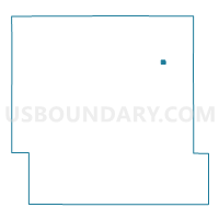
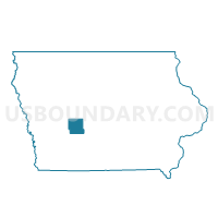
YALE Voting District, Guthrie County, Iowa
About
Outline

Summary
| Unique Area Identifier | 582212 |
| Name | YALE Voting District |
| County | Guthrie County |
| State | Iowa |
| Area (square miles) | 0.27 |
| Land Area (square miles) | 0.27 |
| Water Area (square miles) | 0.00 |
| % of Land Area | 100.00 |
| % of Water Area | 0.00 |
| Latitude of the Internal Point | 41.77537170 |
| Longtitude of the Internal Point | -94.35721160 |
Maps

Graphs
Select a template below for downloading or customizing gragh for YALE Voting District, Guthrie County, Iowa


Neighbors
Neighoring Voting District (by Name) Neighboring Voting District on the Map
- CASS TWP W/O YALE Voting District, Guthrie County, IA
- RICHLAND TWP W/O YALE Voting District, Guthrie County, IA